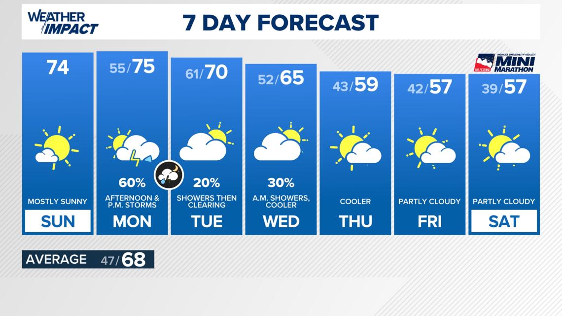
This weekend concludes quietly. Attention now shifts to Monday, with a risk of several storm fronts, some potentially strong to severe.
INDIANAPOLIS — This weekend concludes quietly. Attention now shifts to Monday, with a risk of several storm fronts, some potentially strong to severe.
FOR TODAY
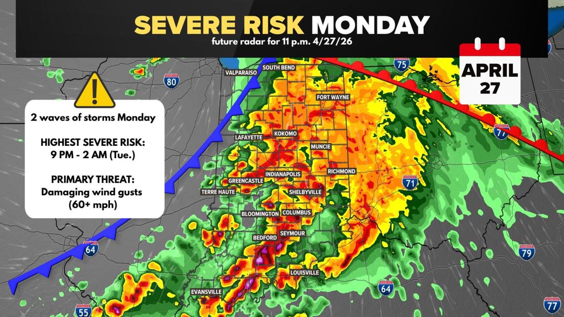
After initial cloudiness, skies will clear to mostly sunny this afternoon. A gentle easterly breeze will have minimal effect as temperatures rise above average into the mid-70s.
FOR TONIGHT
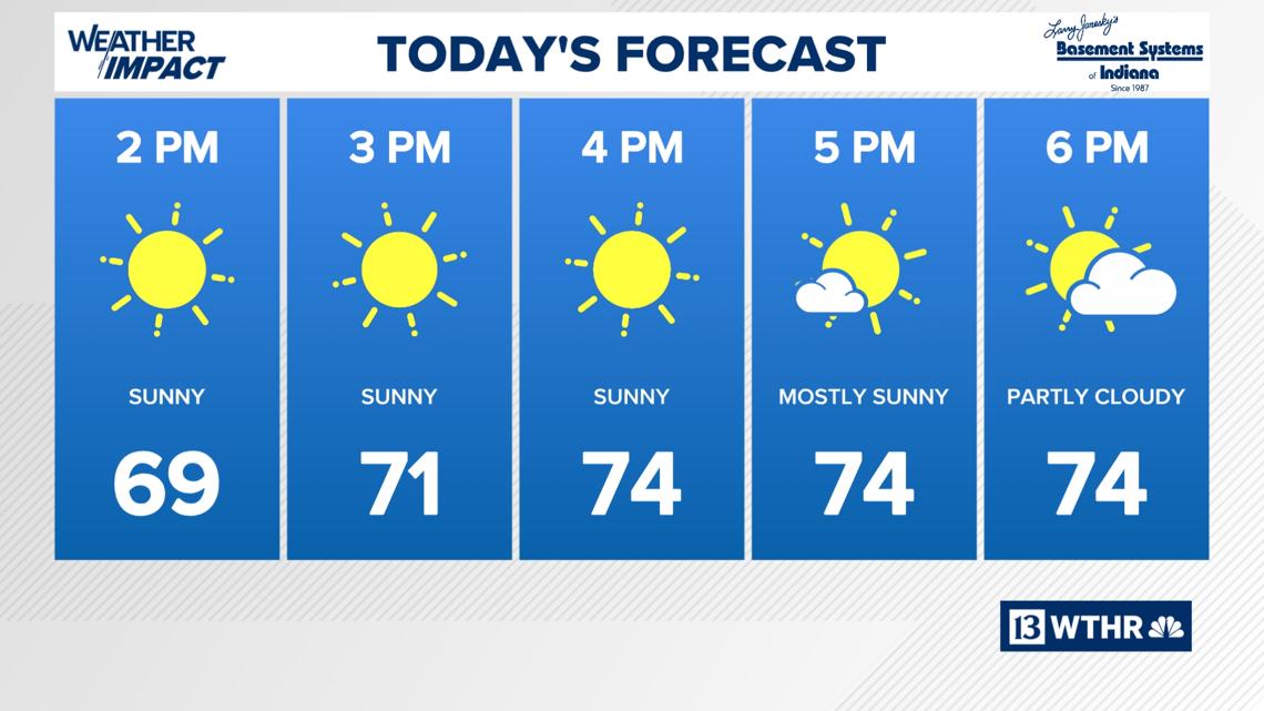
Expect mostly clear to partly cloudy conditions. It won’t be as cool, with winds shifting to the southeast and gusting up to 20 mph.
Monday’s Multiple Storm Waves
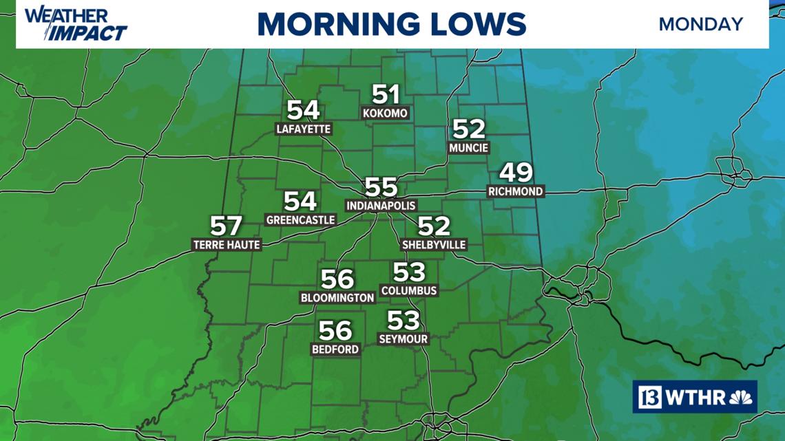
Following a dry start, a warm front will traverse Indiana, introducing scattered thunderstorms mainly after 1 p.m. This presents a minor severe weather risk.
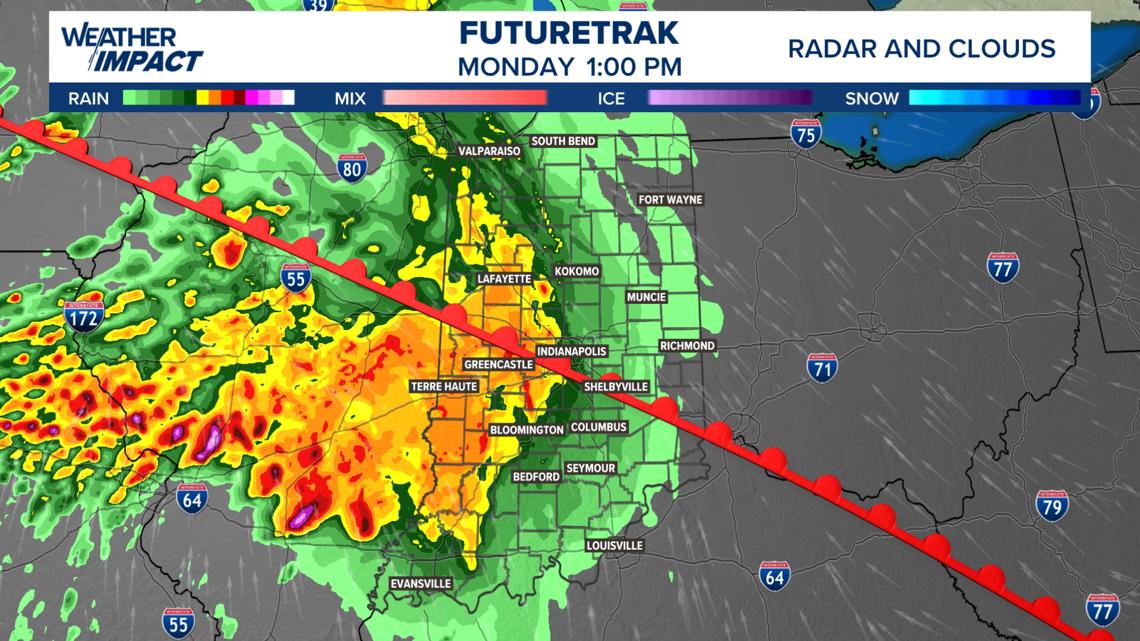
With the region situated within the warm, moist sector of this weather system, conditions are ideal for storm development as a cold front approaches Monday evening.
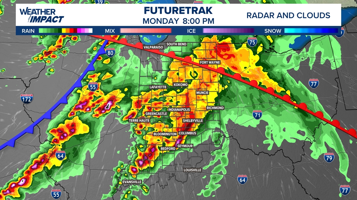
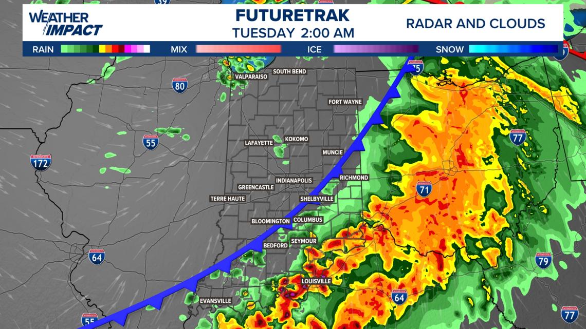
SEVERE STORM RISK WINDOW: Monday evening 9 p.m. through Tuesday morning 2 a.m.
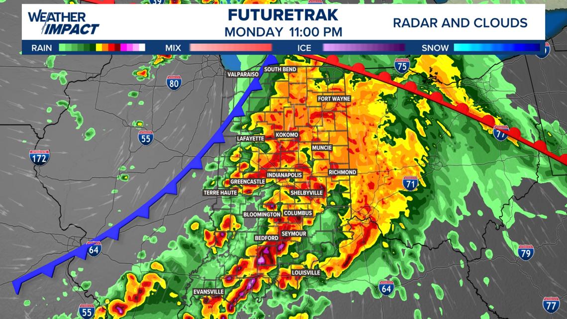
SEVERE STORM RISK OUTLOOK: The Storm Prediction Center has identified Indiana’s western border as having a Level 3 out of 5 risk for scattered severe storms. As these storms are expected to lose intensity moving eastward, the rest of Indiana currently faces a Level 2 out of 5 risk for less widespread severe weather.
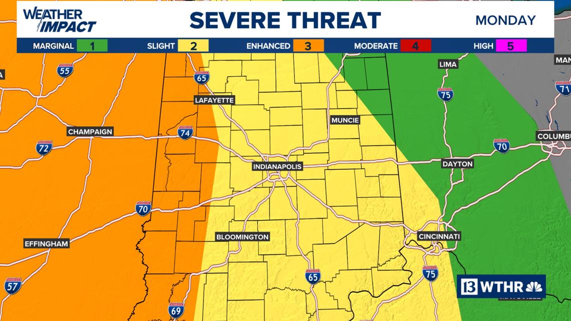
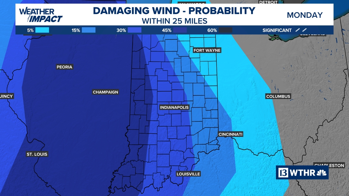
PRIMARY HAZARDS: Initially forming in Illinois, storms could bring all types of severe weather, including tornadoes, large hail, and powerful wind gusts. As these systems are predicted to coalesce into a line moving into Indiana, the primary danger will transition to damaging wind gusts, though isolated rotating storms cannot be entirely discounted. This storm line is projected to weaken as it traverses Indiana from west to east, dissipating by approximately 2 a.m. Tuesday.
Cooler Temperatures Commence Wednesday
Another weather system will pass through late Tuesday and early Wednesday, bringing additional rain and isolated storm activity. This system will dramatically alter our temperature pattern, as a colder air mass will dominate the region, leading to a drop in temperatures from Wednesday onward throughout the extended forecast period.
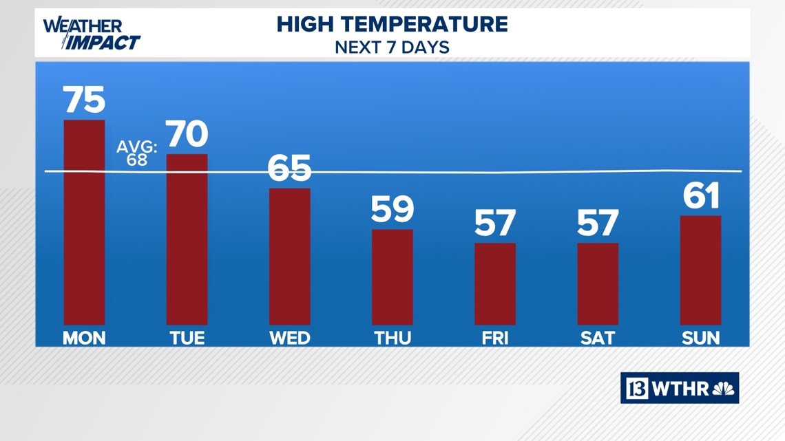
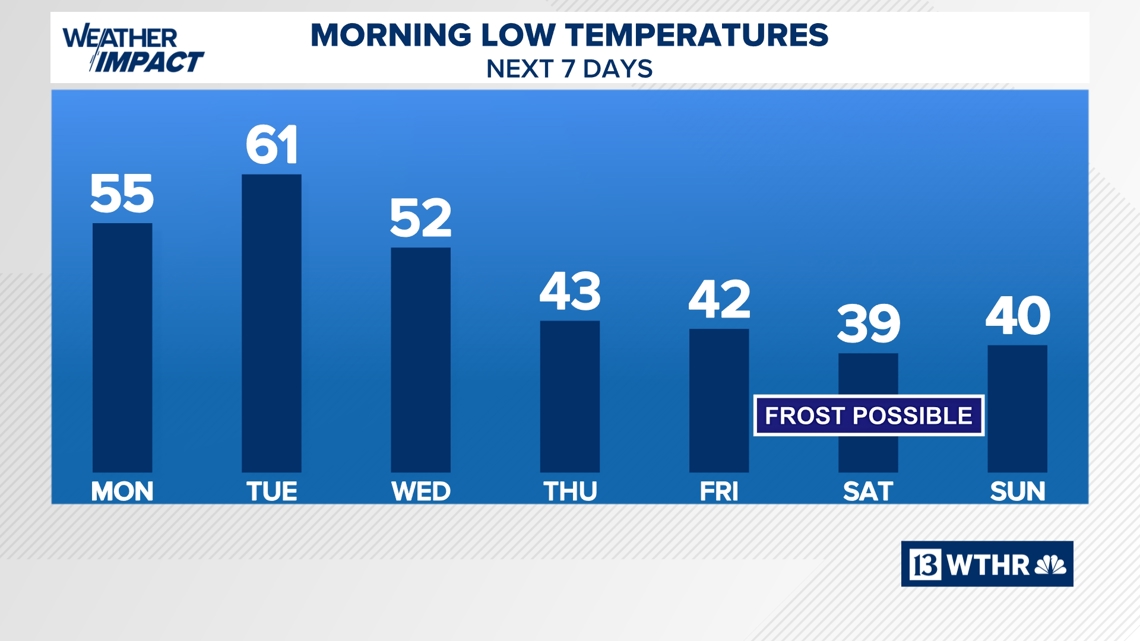
Chilly conditions are still anticipated for Mini-Marathon Saturday, with morning lows potentially reaching the upper 30s and daytime highs only in the upper 50s.