Severe Weather Threat: Tornadoes, Hail, and Strong Winds for the Plains
The Plains and Midwest regions face a hazardous stretch of weather, encompassing the weekend and extending into early next week, with substantial risks of tornadoes, large hail, and destructive winds persisting until Tuesday.
Below, we detail our most recent forecast for each day of this ongoing severe weather event.
(MORE: Guidance for Severe Weather Safety)
Current Situation
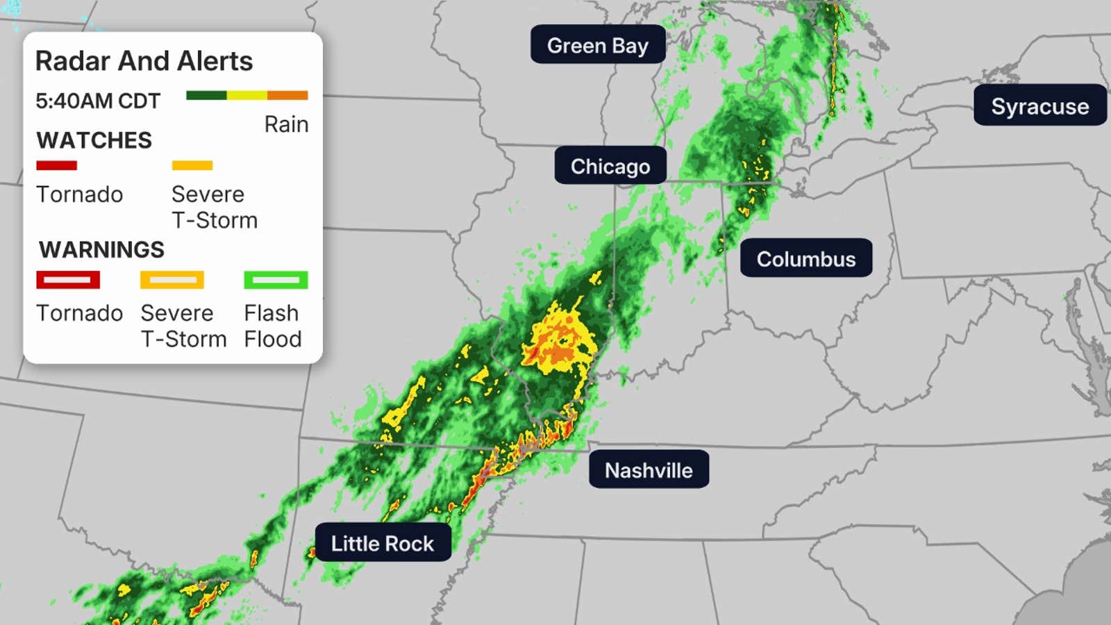
Thunderstorms are forecast to develop across the Plains and continue through the night. The Central Plains to the Arklatex region could experience very large hail, isolated tornadoes, damaging winds, and localized flooding as these storms track southeast. Already, storm chasers have reported multiple tornadoes in southern Oklahoma and western North Texas.
Currently active tornado watches are indicated by red polygons, and severe thunderstorm watches by yellow polygons. The most recent radar imagery is displayed below.
Sunday’s Outlook
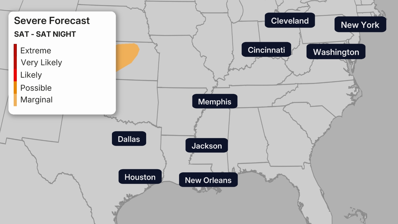
Supercell thunderstorms pose a significant risk across the Central and Southern Plains, particularly impacting areas of Kansas, Nebraska, and Missouri.
Given favorable conditions of warm, moist air and substantial wind shear, these supercells have the potential to generate powerful tornadoes, along with extremely large hail and destructive wind gusts. Residents in cities such as Kansas City and Oklahoma City should remain vigilant.
A reduced but still present severe storm risk, involving large hail and damaging winds, might affect metropolitan areas including Dallas, San Antonio, and Austin.
Monday’s Forecast
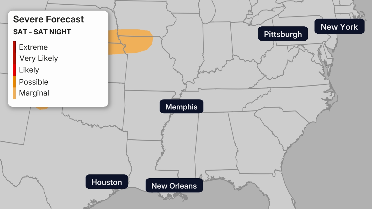
By Monday, the elevated severe weather threat is projected to extend into the Mississippi Valley and lower Ohio Valley. This day could see another round of supercells producing powerful tornadoes across portions of Iowa, Missouri, and Illinois. The potential exists for some long-track and especially hazardous tornadoes.
Major cities such as St. Louis, Kansas City, Little Rock, Nashville, Indianapolis, Chicago, and Des Moines are advised to be prepared.
Tuesday’s Predictions
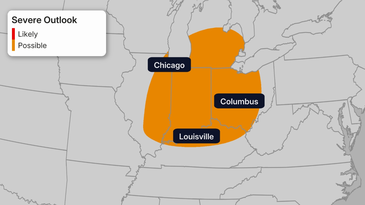
Although still several days away, the persistent frontal boundary may trigger severe storms across parts of the Gulf Coast states by Tuesday. The most significant risk zone extends from northeastern Texas through northwestern Alabama. Residents in cities such as Memphis, Little Rock, Shreveport, and Huntsville should closely monitor weather updates.
Risk of Flooding
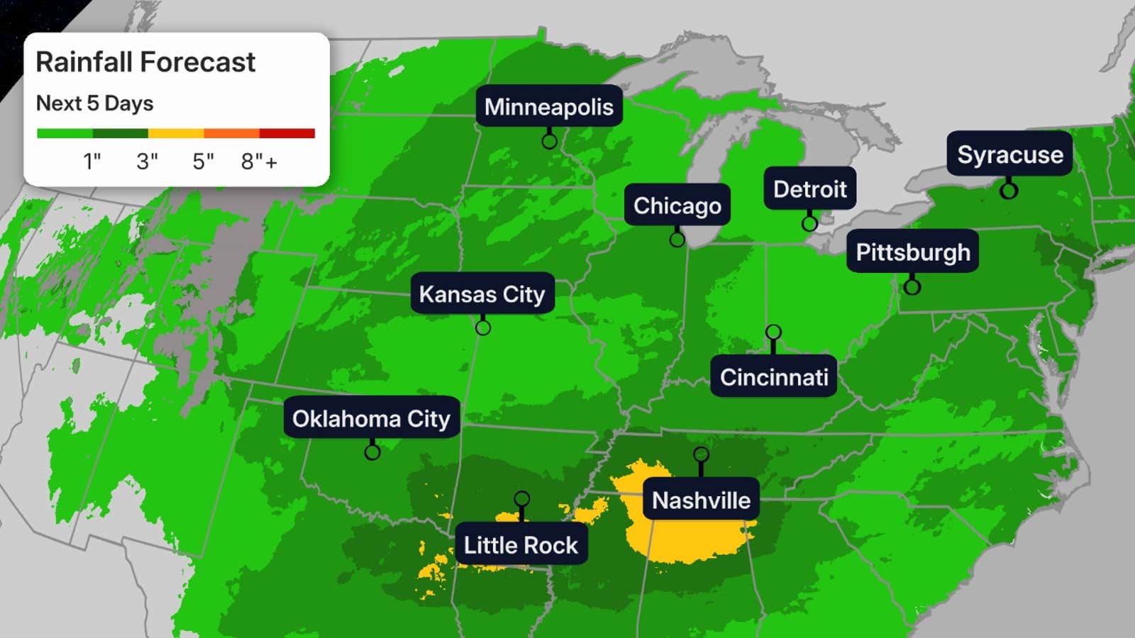
The current stormy weather system is set to deliver additional rainfall to sections of the western Great Lakes, areas already struggling with ongoing flooding or where the ground remains waterlogged from heavy rains last week and earlier this spring.
Although rainfall totals are not expected to reach last week’s levels, more than an inch of additional rain is highly probable across much of the Midwest by Monday. This could trigger at least isolated instances of further flash flooding and potentially impede the recession of flooded rivers.
Localized heavy rainfall, leading to flooding, is also a possibility through Monday, affecting areas from portions of Missouri and Kansas extending into Arkansas and the mid-South, despite some of these regions currently experiencing extreme drought conditions.
Exercise caution regarding flooded roadways, particularly during nighttime hours when they may be less visible. Under no circumstances should you attempt to drive through a flooded road; always seek an alternative route.
(MORE: Guidelines for Flash Flood Safety)
Event Summary
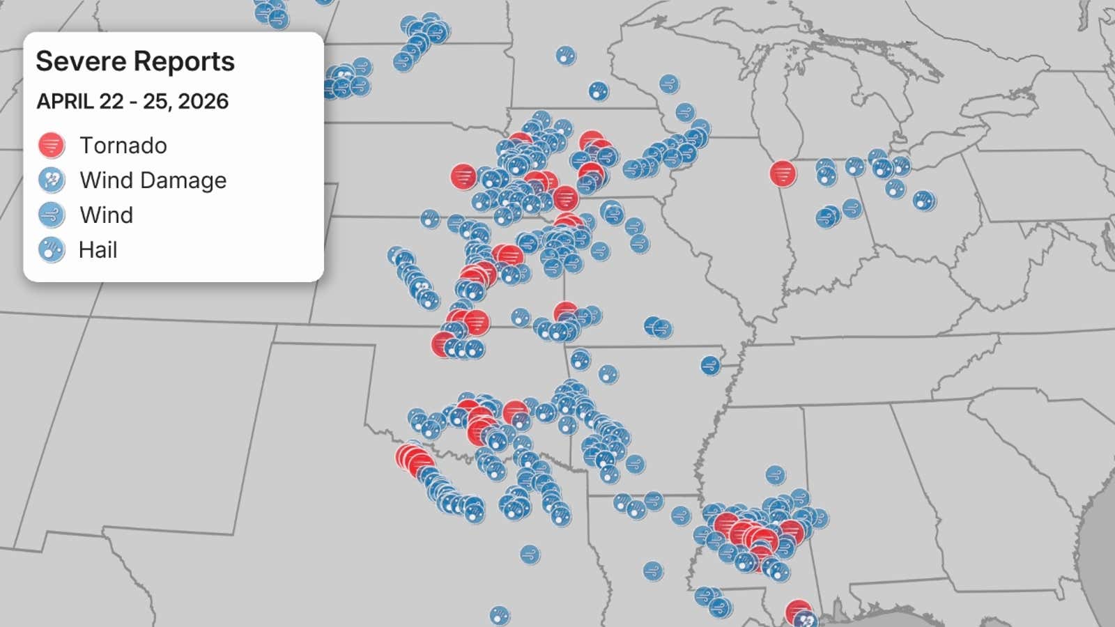
On Thursday, more than 20 tornado reports were documented from Oklahoma up to Iowa, alongside a combined total of over 160 reports of damaging winds and hail.
Thursday evening saw the issuance of an uncommon tornado emergency for the storm that devastated Enid, Oklahoma, and the adjacent Vance Air Force Base, alerting to potential catastrophic damage and extreme danger. The subsequent tornado was classified as an EF4, featuring wind speeds between 170-175 mph. This marked Garfield County, Oklahoma’s first EF4 tornado since April 26, 1991, and resulted in 10 reported injuries.
Additionally, the National Weather Service office in Norman, Oklahoma, documented five other tornado occurrences.
The Norman NWS office highlighted that this was merely the ninth occasion it had issued a tornado emergency.
(MORE: Understanding Tornado Warning Classifications)
A wind gust reaching 107 mph was also recorded at Vance Air Force Base, Oklahoma. The most notable hail report detailed softball-sized hail, measuring 4 inches in diameter, in Marion, Kansas.
As predicted, Friday experienced less severe impacts. Only one tornado report originated from Kiowa, Oklahoma. The day still saw over 75 combined reports of damaging winds and large hail. The storm reports for this recent event are summarized below.
Previous Week’s Outbreak
The brief respite early in the week was undoubtedly a relief following the intense period last week. Observe the striking resemblances between the reports on the April 13-17 map below and the preceding map illustrating the most recent storm activity.
Last Friday alone recorded 96 tornado reports, contributing to a total of over 500 severe weather incidents.
(MORE: Unusual Aspects of April’s Severe Weather)
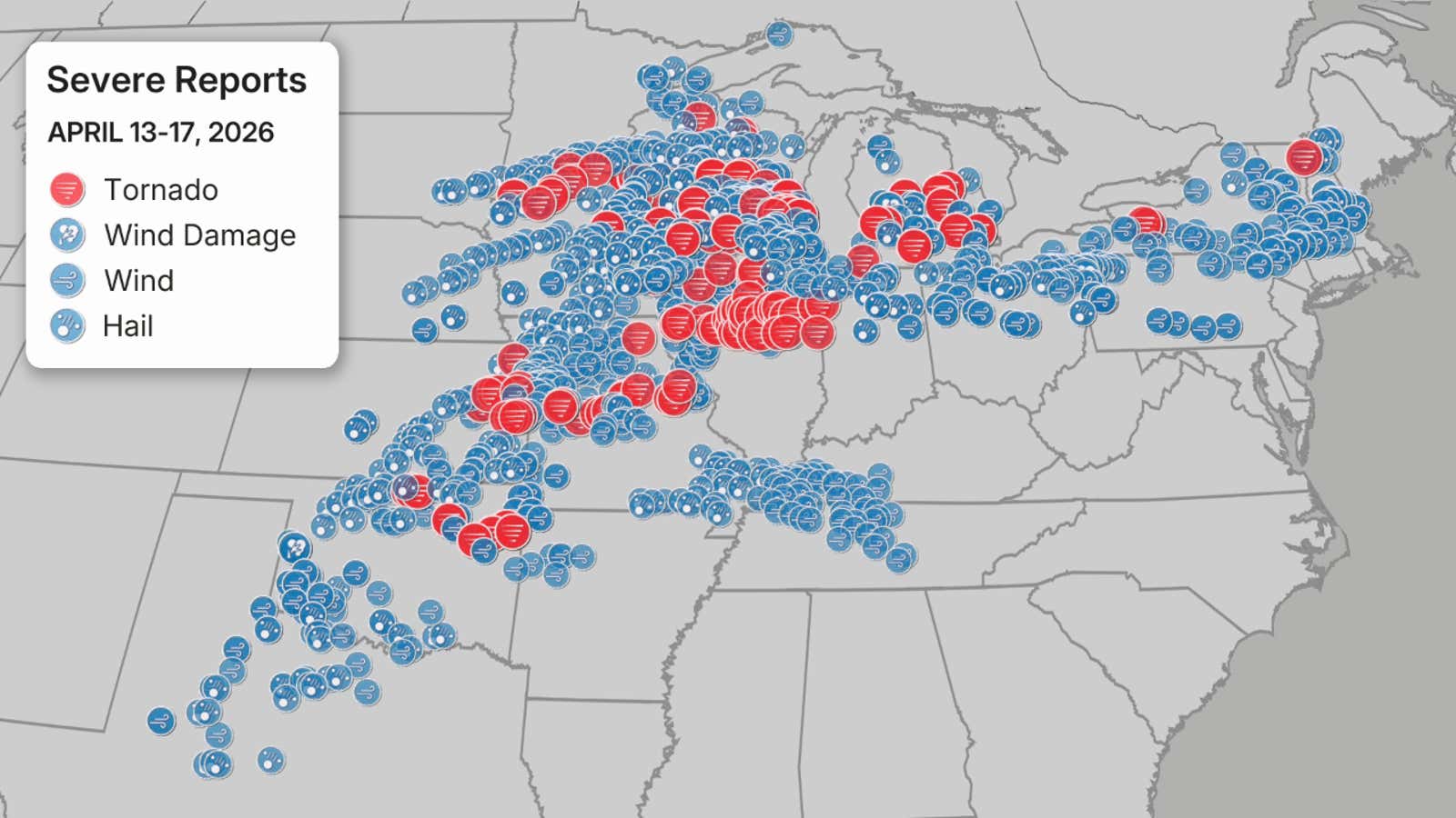
Documentation of substantial hail, thunderstorm wind damage, powerful wind gusts, and tornado sightings from April 13-17, 2026. Important: The number of tornado reports may not precisely reflect the true count of tornadoes, which is definitively established through NWS damage assessments.
(Source: NOAA/NWS/SPC)
Cumulatively, the United States experienced more than 1,300 severe weather reports from last Monday to last Friday, comprising 154 tornado reports, 532 hail reports, and 642 reports of thunderstorm-induced wind damage or strong gusts.
Evidently, several regions facing an elevated risk of impending severe weather are the very same areas that endured significant impacts from severe weather last week.
Ensure you have diverse methods for receiving alerts in the event of severe weather.
Jennifer Gray is a seasoned weather and climate writer for weather.com. She has reported on many of the globe’s most significant weather and climate events for two decades.